30 Years Later Should MLK Boulevard Have Ever Been Built?

In 1982 Downtown Baltimore and West Baltimore were very different places. Downtown was still in shambles unless you were at the Harbor or Charles Center and not a block further from those places. The Westside of Downtown was feeling the effects of suburbanization while West Baltimore was entrenched in a decades long drug war centered in Lexington Terrace and Murphy Homes. This was the urban climate in which Martin Luther King Jr. Boulevard (MLK) was built. It served and still does serve as a bypass to Downtown and was supposed to be a quick route to get to midtown. MLK ends at Chase St. right in between Bolton Hill and Mount Vernon at the State Center. If MLK Boulevard was supposed to act as a thoroughfare like it was supposed to it would have had an interchange with I-83, I'm thinking like a mid to late 20th century highway planner in order to reenact the climate of 1982 where it was still a "good idea" to destroy City Neighborhoods in order to build highways. MLK Boulevard has since become just another north south route through Downtown with the same amount of gridlock as the very streets it was supposed to bypass begging the question; Should MLK Boulevard  Have Ever Been Built?
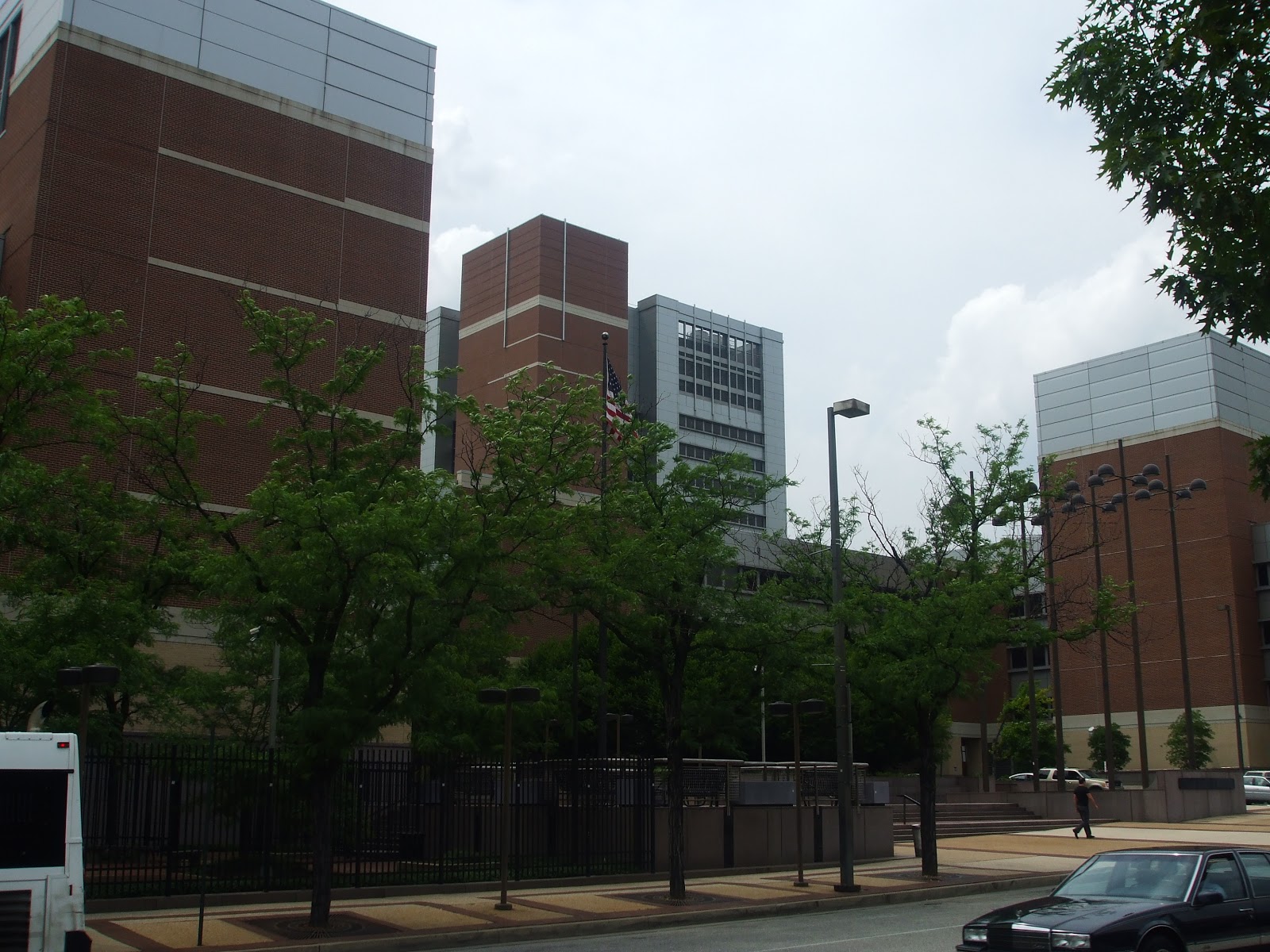
West Baltimore and the western edge of Downtown was something to be bypassed in 1982 and in the planning and construction years leading up to it as well. Stately Neighborhoods such as Ridgley's Delight and Barre Circle had not yet gentrified and Pigtown was in worse shape than it is now. The Stadiums (M&T Bank and Camden Yards) were a good 10-20 years away from materializing and Lexington Terrace and Murphy Homes were war zones. So long story short, the MLK Boulevard corridor was in shambles. The only real draws were State Center and the massive Social Security Building. These were nothing but Office Buildings without any Retail or Residences nearby and the workers in those buildings lived in the suburbs or on the outskirts of the City. Given the state of the Neighborhoods surrounding State Center and the Social Security Building workers didn't exactly want to stick around the City after hours.
So this begs the question; What is a bypass? Well as its name suggests it bypasses a certain area that's congested and provides a shorter unclogged route. So does MLK Boulevard bypass Downtown? Yes it does but it doesn't do it in a manner that's much faster than say Howard St., Calvert St., or Charles St. so in that aspect at least given today's landscape of the road and its surrounding areas, it fails as a bypass. Also I can't help but wonder if earlier in the planning stages if MLK was supposed to be more limited access. Sure, there are the bridges at the road to nowhere but those still have traffic lights on MLK. Could MLK Boulevard have originally been a freeway with grade separated interchanges? I haven't seen evidence of it but I given the sad state of West Baltimore and the Government's willingness to plow through distressed Neighborhoods in the name of Highway Construction, I wouldn't have been surprised if that had been discussed.
Another way to more effectively make MLK Boulevard more of a limited access freeway to merely cut off access to east west roads like they have done with Lexington St. Granted there's still a traffic light there due to heavy pedestrian activity but having other streets stop and start on either side of the Boulevard would have made for faster travel times and allowed it to have nothing to do with the Neighborhoods it's bypassing. With that being said, MLK Boulevard was quite successful in bypassing Downtown in its early years because the route it took was relatively deserted. 
Then around the late 1980s, Neighborhoods along MLK Bouleard began to experience one by one. First came Reidgley's Delight which went through a similar homesteading experience that Otterbein did just under a decade earlier. Now Ridgley's Delight is an ultra sought after address. 
Next came Oriole Park at Camden Yards Its April 1992 opening date set a new standard for Baseball Stadiums across the Country      and it increased traffic on MLK Boulevard and all of Downtown during home games so much so that Lee St. got its own exit from MLK Boulevard while it's still considered part of I-395. 
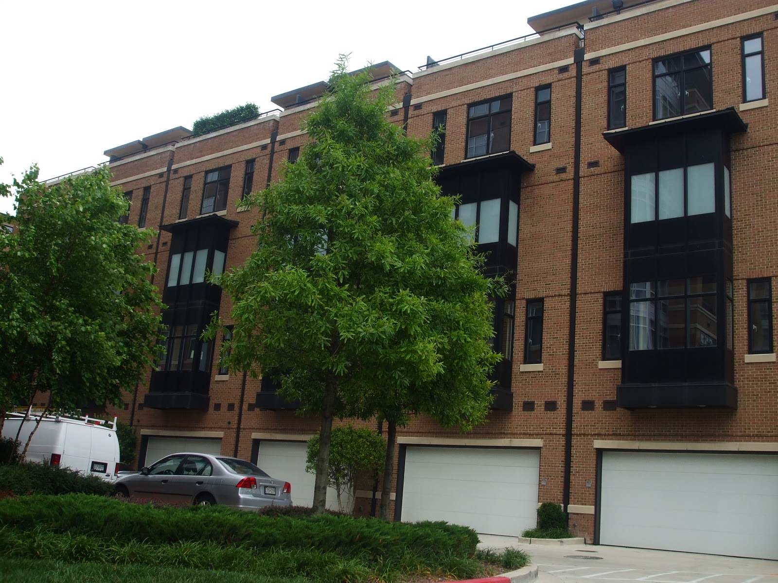
In 1996 the first of two pubic housing high rise developments were demolished; Lexington Terrace which directly abuts MLK Boulevard. This scary development was over run by drug dealers, violent crime, and deplorable living conditions. This and the adjacent Murphy Homes may have been to blame for the bad reputation of the Boulevard. In 2000 "The Townes at the Terraces" was completed on the site of Lexington Terrace. This new mixed income Community contains mostly Town Homes 1/3 of which are market rate home ownership while the rest are public housing. In addition there's an 88 unit Apartment Building for Seniors. Upon completion of the Terraces, crime has gone down and the quality of life has gone up.
In 1998 following the footsteps of Camden Yards M&T Bank Stadium opened across MLK Boulevard from Camden Yards on land originally cleared for the first stadium. This, like Camden Yards set the new standard for building of future stadiums. It most certainly increased traffic on MLK Boulevard especially during game days. 
In 1999 Murphy Homes was demolished, located just across the road to nowhere from Lexington Terrace Murphy Homes had also fallen victim to the crime, blight, and drugs that so much of Baltimore had and continues to from the latter half of the 20th century until this day. In 2003 Heritage Crossing was completed. As Murphy Home's successor there's no comparison. Unlike the Terraces the majority of the new Town Homes are market rate home ownership and a minority are public housing units. Heritage Crossing also boasts more green space and a much more suburban appearance. Like the Terraces the successor is worlds better than its predecessor. 
Very quietly University of Maryland at Baltimore (UMB) has been expanding its campus from to engulf everything from MLK Boulevard to the west, Greene St to the east, Fayette St. to the north and Pratt St to the south. Recent additions include 
The Institute of Virology Opened in 1996 
A new Library that opened in 1998
A Museum of Nursing that opened in 1999
New School of Law Building opened in 2002
New School of Dentistry opened in 2006
Institute of Genome Science opened in 2007
New Southern Quad opened in 2009
New Ambulatory Medical Center slated for 2012
All of these expansions in both program and space has made for larger enrollment at UMB and still more traffic on MLK Boulevard. As new buildings open it gives the University the opportunity to renovate, expand, and modernize older existing buildings. In addition to the School itself generating more traffic the adjacent Neighborhoods have become magnets for Students of UMB. MLK Boulevard has become filled with Students who live in Ridgley's Delight, Pigtown, Hollins Market, and Barre Circle and walk to School. 
Speaking of UMB and crossing MLK Boulevard, UMB has been constructing a new Biotech Park since roughly 2005. It's going along West Baltimore St. in Poppleton on the grounds of dilapidated row homes. The new heavily guarded park is slated to bring new jobs to the area and will boost redevelopment efforts throughout Poppleton. 
There are future plans along MLK Boulevard; State Center. The very suburban park is slated to be redeveloped and bridge the gap between Mount Vernon, Bolton Hill, Upton, Seton Hill, and Heritage Crossing. This project has had numerous pit falls and controversies. First off, there are those who think the State shouldn't be investing that kind of money during a recession, the State's developers Streuver Brothers, Eccles, and Rouse going bankrupt, the design having to be modified because McCulloh Homes are no included, and a host of other hurdles that have halted construction that should have been underway many times over.
There were also plans at one point to extend MLK Boulevard to meet I-83. This would be disastrous to all of the Neighborhoods nearby as it would destroy their fabric and some very beautiful row homes might be destroyed in the process. It's also interesting that this wasn't done 30 years ago. MLK Boulevard just stops at Chase St. where had it continued would have cut through Mount Vernon and Bolton Hill. These Neighborhoods 30 years ago were in decent shape while the rest of the Neighborhoods surrounding the Boulevard were not. That gives me insight into the state of mind that the planners were in that they only wanted to disrupt poor distressed Neighborhoods while leaving wealthy Neighborhoods alone. That was just a little side note I found quite interesting.
Now that I have given a history of MLK Boulevard from 1982-2012 and beyond it comes time to answer the burning the question; Should MLK Boulevard Ever Been Built? My answer; Yes, it started out as a bypass from Downtown heading Uptown with very few traffic jams. Now that the area has gone through and will continue to go through a massive transformation it has stopped being a bypass because it takes almost as long to get Uptown than if you drove straight through Downtown. So if it failed as a bypass why should it have been built? Well I will answer that with a question; How could all of these new Stadiums, gentrified Neighborhoods, and expanded University without this new road to support the additional traffic?

Lets Dust Off the Shelves

 
There's no doubt that Baltimore has had to put some development projects on hold because of the great recession and some of those high profile developers (Streuver Brothers Eccles & Rouse comes to mind) have gone belly up. That would make reviving some of these once prospective developments will be that much harder to revive. Now that the economy is showing some signs of improvement some developers who haven't gone bankrupt are dusting off their portfolio shelves and reviving projects they have had to put on hold.
If one drives along I-95 just before the I-395 ramp one can see that Patrick Turner's Westport is beginning its infrastructure improvements to make way for its high density waterfront development with the first apartment building expecting to be completed in the next couple of years. I'm using the continuation of construction of Westport construction as a signal for other developers to begin dusting off the shelves and revive their old projects that I like. Lets take a look down memory lane at some proposed projects that were on hold indefinitely. 
30 East Pratt-Forget Harbor Point and Inner Harbor East, this might be the most valuable piece of undeveloped Real Estate in the City. Where else along Pratt St. in Downtown can you find a vacant lot just waiting for a daring architect to build their dream sky scarper? If you can't think of anywhere else that's because 30 East Pratt is the only place. Sure, there are buildings along Pratt St. that due for major renovations and modernizations to stay current but I can't think of any that need to be torn down and that's the only way to create more vacant lots on Pratt St. in Downtown. 
Conway & Light St- This was once part of the McCormick Schmidt plant that graced the industrial Inner Harbor of yesteryear. The Intercontinental Hotel took up a good deal of this space but there is still a vacant lot at the corner of Light and Conway that's used as a pay lot that over charges. There was a proposal to build a sky scraper here that was promised to alter Baltimore's skyline. This modern building is expected be mostly glass and contain a mix of uses including a Hotel, ground floor Retail, and Apartments or Condos. Like 30 East Pratt this is a prime piece of Downtown Real Estate especially when considering how close it its to the Stadiums and Light Rail.  
Guilford/Holiday/Saratoga- This little known piece of land at the eastern edge of Downtown what had a proposal to build a mixed use centre that would most likely be Offices and Retail. Located just steps from "the Block" it wouldn't be the best location for Residential uses. Given that there won't be much of a reduction in the amount of vacant office space Downtown especially when considering that Exelon is building its big new headquarters in Harbor Point and that will vacate the Constellation Energy Building. I don't see this project at Guilford, Holiday, and Saratoga getting off the ground anytime soon. It should at the very least still be talked about so it doesn't fall through the cracks.
The Mechanic Opera House-The victim of Charles Center Era architecture was shuttered and is awaiting redevelopment. Davis S.Brown Enterprises is looking to redevelop it and reopen the old opera house in a modern venue with Retail surrounding it and a Hotel and Residences above it. There have been pitfalls other than the recession for this ugly building, mainly conversationalists who think its architecture is historically significant. I whole heatedly disagree with them and believe that this prominently located parcel (Charles and Baltimore St.and just steps from the Metro) is holding back a potential revival of Downtown's Charles Center District. I say redevelop the Mechanic full speed ahead.
Waterview Overlook- Cherry Hill is finally realizing that it has some waterfront access to the Middle Branch. With the Billions being reinvested next door in Westport a developer before the recession saw a vacant parcel of land in Cherry Hill along Waterview Avenue and bought it. It was rezoned to permit the construction of Condos and Town Homes named Waterview Overlook. Although located in Cherry Hill one wouldn't have to drive through Cherry Hill to get there. Developers cleared the land to start construction but then the recession hit and Waterview Overlook's developer went bankrupt. Earlier this year the land was sold at a bank ordered auction. Since the land is zoned for a project like Waterview Overlook it's safe to say that the whoever bought this land will revive it in some way unless they seek to rezone it. 
Vistas on the Lake- Finally a development that takes advantage of Druid Hill Park's breathtaking views. Vistas on the Lake, proposed to be located in Reservoir Hill on a vacant parcel with Druid Park Lake Drive frontage overlooking the lake. Reservoir Hill has been on the verge of a comeback for many years and resurrecting Vistas on the Lake would be give it a huge shot in the arm. Although this project was been shelved due to the recession it was officially taken off the books when HUD claimed that the land it was to be built on had a lien on it that only allowed for Section 8 housing. I think the lien is a hindrance to large scale redevelopment throughout distressed areas of Reservoir Hill and should be lifted if only for the sake of Vistas on the Lake.
Residences at Lexington Market- The Westside of Downtown has had some modest success stories by rehabbing old buildings but there hasn't been much in the way of new building. The Residences at Lexington Market would have consisted of two high rise Apartment Buildings, a high rise Condo Building and 23 Town Homes all built atop a small parking garage (pictured above.) In addition to being a great asset to Lexington Market these 300+ new homes would have breathed new life into the Retail of Downtown's westside which is still suffering from the flight to the suburbs half a century earlier. This project was supposed to be built by the same developers as Waterview Overlook which had gone bankrupt. I haven't read anything regarding the resurrection of this project. I would love to see this built considering its proximity to both the Light Rail and Metro, this whole area could be a transit hub if done right.
O'Donnell Square- Located in the up & coming Greektown Neighborhood Ed Hale of 1st Mariner Bank Fame had purchased an old industrial swath of land near the recently completely Athena Square Town Homes on Oldham St., O'Donnell Square was supposed to be roughly 1100 units of luxury Apartments and Condos in high rises. What has been built so far without Ed Hale's backing has been 121 Town Homes. Given how well Athena Square sold during the recession, I think this was a wise choice for now. Given how close to the Harbor and Canton this is I would advise that the remainder of the land be used for Apartments & Condos. Supposedly that land is zoned for about 800 additional units but no further development plans have come through as of yet. 
Somerset Homes- This once distressed public housing development was demolished in 2009 to make way for an empty field at least that's what's there now. Then Mayor Shelia Dixon had this development demolished without any real plans or funds to rebuild. The land has been banked as part of a land banking program that former Mayor Dixon had championed. When the Master Plan for the Oldtown Mall area was completed it listed a few different options of varying densities to build on this land. I prefer a mix of high density Apartments and Town Homes with a mix of incomes. Given that East Baltimore is experiencing a rebirth due to the Hopkins Biotech Park and associated residential redevelopment the site of Somerset Homes will become a valuable piece of land.
Gateway at Washington Hill- Also near Hopkins in East Baltimore in the hot Washington Hill Neighborhood next to Butchers Hill this vacant parcel of land has been zoned for high density Apartments with ground floor Retail. The Retail will provide a much needed niche for Residents of Washington Hill, Butchers Hill, and Broadway Overlook who feel their Retail options are limited because East Baltimore's Retail hasn't caught up with the influx of new middle class Residents. Unlike some of the other developments discussed in this post, Gateway at Washington Hill is a lot closer to getting built. I think Gateway at Washington Hill is proof that East Baltimore has turned a corner for the better.
 
 I'm happy to say that the environment for building in Baltimore has become friendlier in the past year although not perfect it's definitely better than it was from 2007-2011 and with that good news it's time to dust off the shelves and revive these and more great projects. 

Road to Nowhere: A Phased Redevlopment Plan with a Little Help from my Friends

 Lately I have been focusing on the Road to Nowhere. There have been parts of the City that readers have told me that nobody other than me sheds light on. The Road to Nowhere is not one of those places. Everybody, including me have pondered its future and have tried to pull it out from despair and into a 21st century successful mixed use Neighborhood. As I have pondered its future I came up with some ideas but then I realized I already read them on other blogs, in fact the blogs belonged to fellow bloggers and think tankers like me Gerald Neilly and Peter Tocco. So, for this post regarding the Nowhere I got a little help from my friends.
Photo From AA Road Guides.com
It's obvious that the Road to Nowhere needs helps and that in its current condition, itself and its West Baltimore Neighbors will only worsen. There has been some improvement lately along here in the form of HOPE VI developments Heritage Crossing and Townes at the Terraces replacing Murphy Homes and Lexington respectively. These new low density Town Home development didn't change the layout of the Road to Nowhere which I believe is where the road to block lies.
Photo AA Road Guides.com
 One reason it's called the Road Nowhere and perhaps the biggest is because it is completely useless. It was meant to act as a spur to connect I-70 to Downtown while I-70 was on its way to meeting I-95 near Caton Avenue. Well construction began on this spur located between Franklin and Mulberry Streets in West Baltimore. However the phase of I-70 that was supposed to extend it from the western edge of Leakin Park to I-95 was halted due to outcry from citizens who were against having a highway run through Leakin Park. This, along with the prospect of extending I-83 through Fells Point and Canton elevated the profile of Barbara Makulski and eventually made her the senior US senator from Maryland. What the Road to Nowhere is now was the beginning and end of that attempt to extend I-70 from Leakin Park.
Although all of the Road to Nowhere is terrible shape, we must focus on specific areas and phase redevelopment. The only real interchange the Road to Nowhere has is with MLK Boulevard. At this interchange, traffic exits from the "freeway" where it rejoins Mulberry St. for a signalized intersection with MLK Boulevard. Those who continue on the "freeway" simply go over a bridge over MLK Boulevard where they rejoin Mulberry St. at the western edge of Downtown. This shows how useless the bridge is going eastbound. Lets see how useful it is or is not going westbound.
Photo From AA Road Guides.com
When approaching the Road to Nowhere westbound you're more or less exiting Downtown and venturing into West Baltimore. While on Franklin St. you will have the option to bare left to go on the Road to Nowhere or to stay on Franklin St. for a signalized intersection with MLK Boulevard. It is assumed that if you remain on Franklin St. your destination is MLK Boulevard but it doesn't have to be. Traffic entering both Franklin St. and the Road to Nowhere uses that signalized intersection as well. Theoretically, if you went straight at the intersection and just stayed on Franklin St. you could avoid the Road to Nowhere for its entire length.
Photo From AA Road Guides.com
 When turning onto Franklin St. from MLK Boulevard (west of the bridges) you have to the option of baring left to enter the "freeway" or stay on Franklin St. This little ramp is where Fremont Avenue would have met the Road to Nowhere but instead stops and starts up again at either end of it. So what I've basically determined in these last two paragraphs is that the MLK Boulevard bridges are completely useless.
So, demolishing the bridges and rerouting traffic onto Franklin St. instead of the Freeway is step one thus closing the entire westbound section of it from MLK Boulevard to Monroe St. The eastbound section of the can remain in operation until redevelopment or the Red Line calls for its closure. It will be shortened however to allow for the demolition of the MLK Boulevard bridge so that all traffic will exit at the ramp and rejoin Mulberry St. before crossing MLK Boulevard. Demolishing these bridges will free up a lot of land in between Heritage Crossing and the Terraces. This will constitute Phase I of redevelopment. Since both the Terraces and Heritage Crossing are both lower density Town Homes, I believe it best to streamline those two developments by making the new Neighborhood low density Town Homes as well. The new development will go from MLK Boulevard to Fremont Avenue, which will be reopened at the freeway where access was cut off during its construction. Hopefully this new Neighborhood renamed "Franklin Mulberry Crossing" will spur new development further down the freeway. I think the demolition of the MLK bridges will symbolize a new era of investment and development in all of West Baltimore.
Phase II of redevelopment should occur east of the bridges at the edge of Downtown. I'm speaking of course about the mammoth Social Security Building. Rumor has it that they will be moving to the State Center just a few blocks northwest and this building could and should be demolished. This coupled with its monster parking garage will free up a huge swath of land stretching from Greene St to the east, Franlkin St. to the north, Saratoga St. to the south, and MLK Boulevard to the west. This will be the perfect opportunity for a high density mixed use Residential, Commercial, and Ground Floor Retail Center that will serve a true western gateway to Downtown. In addition, parking garages will be built in the center of the buildings so they are masked to the naked eye.
Phase III of redevelopment involves the Terraces and their frontage on MLK Boulevard. There 's a very busy Rite Aid located here and I think it should redeveloped to create a row of Neighborhood Retail along MLK from Mulberry St. to Saratoga St. Although it will have MLK frontage Violet White Way will serve as a collector street so as not to disrupt traffic on MLK Boulevard. Just south of Saratoga St Violet White Way will be extended so that the site that Lexington Terrace Elementary once stood could be developed as a mid rise low income Senior Apartment Building. Also Lexington St. will be reopened to traffic with a vehicular intersection with MLK.
Finally, we come to Phase IV, the final phase in this plan. Phase IV is the southern border of Seton Hill. Seton Hill contains some of the City's best historic housing stock at the best prices while at the same time has lots of mature trees the gem that is Saint Mary's Park. The southern border of the Neighborhood consists of a triangle that is made up of Pennsylvania Avenue, MLK Boulevard and Franklin St. What's there now are suburban style Garden Apartments that appear to be 1970s urban renewal era that were most likely built around the time of the Road to Nowhere. These will be redeveloped as Row Homes that are reminiscent of classic Seton Hill Row Homes that will look like they've been there the whole time. The only difference is that they will have garages in the back to minimize size of the parking pad. These new homes will have frontage on the three mentioned streets and will back to a small "pocket park" that will act as an extension of Saint Mary's Park.  
Photo From AA Road Guides.com
  There will be other phases that go further down the Road to Nowhere but there are already sufficient plans out there that address that area including the West Baltimore MARC redevelopment, the Red Line, and Peter Tocco's Baltimorphisis which shows a rendering of the freeway redeveloped and transformed and how that will positively impact surrounding Neighborhoods. For this post I turned to other blogs and got a little help from my friends.

New Housing: Its Effects Won't Spread Enough

Great news! Hope VI Developments and those like them are a much more attractive and safer alternative to their high rise or dilapidated row house predecessor. Not so great news, the success of the development isn't helping the rest of the Neighborhood. The goal of redeveloping these hot beds for crime and urban decay wasn't just to get rid of crime and blight at the site that was redeveloped but have the effects of said redevelopment spread throughout the Community. I'm going to examine some of these new developments and their surroundings to see what is keeping their Neighboring Communities from reaping the benefits of redevelopment without redeveloping the entire City.
The theory that existing development will gentrify when new development is built nearby has its merit. All one has to do is look around the Harbor. As it was redeveloped effects of it spilled over into Fells Point, Federal Hill, Canton, Little Italy, and Patterson Park. These row house Communities located near Downtown in the Harbor were once home to industry and the row homes housed the workers in said industries. When manufacturing and shipping left Baltimore so did Residents of these Neighborhoods in search of new work. When the Harbor became a tourist attraction, Residents began flocking back to these Neighborhoods and gentrification spread like wild fire. So when it came time for HOPE VI developments, Residents and City Planners alike were optimistic that replacing high rises with new town homes would gentrify entire Neighborhoods like the harbor. Lets examine these Neighborhoods and see what we're up against.  
First lets go to West Baltimore where two notorious slums were imploded; Lexington Terrace and Murphy Homes. Today they're Town Home Communities known as Townes at the Terraces and Heritage Crossing Respectively. The Road to Nowhere separates these two Communities. Both new developments are located in otherwise bad areas. Terraces are located in Poppleton while Heritage Crossing borders on Harlem Park and Upton. When their high rise predecessors were built, the crime that came with them spilled over into Neighboring private row house communities. 
When Murphy Homes was demolished, a lot of its crime went with it but the damage had already been done in neighboring Upton and Harlem Park. Now its Heritage Crossing Residents who complain about the spillover of crime and drugs from Upton and Harlem Park.
A similar story can be told in the Terraces. Although it has a much higher percentage of public housing units than Heritage Crossing, it is still much better than its high rise predecessor. Poppleton, where the Terraces are located is receiving a good deal of investment other than just the Terraces (something Heritage Crossings' surrounding aren't receiving) this includes the UMB Biotech Park and several blocks of housing that's being redeveloped by the City. One thing the Biotech Park is hoping to do is provide entry level jobs in the Biotech field for local Residents (ones that don't require high levels of education) and lure new Residents in who will be working in the Biotech Park. Whether these goals will come to fruition is yet to be seen. 
I would make the argument that in order for Poppleton to make a full turn around that Poe Homes must be redeveloped as a mixed income community the way  Lexington Terrace was replaced with the Townes at the Terraces. Sadly concentrated public housing like that found in Poe Homes is a deterrent to new Residents, hence the population loss.
Now we go to East Baltimore and its HOPE VI developments. Here, there has been a more positive synergy for change that has allowed some developments to flourish much better than their western counterparts. What I mean is, developments surrounding the new HOPE VI developments have had a more positive spillover effect. 
The first development was Lafayette Courts which is now Pleasant View Gardens. It was a development of public housing high rises that was demolished and replaced with the town homes that we now know as Pleasant View Gardens. The problem with Pleasant View Gardens is that it doesn't have a great enough mix of incomes so almost all of the Town Homes are public housing. It is however a much safer Neighborhood. It also doesn't have very many Residential developments immediately surrounding it so it's hard to gage its success but I'll give it a try none the less. 
To the north of Pleasant View Gardens was Somerset Homes. In 2009 it was torn down and the land has been banked for future development. If Pleasant View Gardens was meant to have a positive spillover effect on Somerset then it failed miserably . Otherwise Somerset would still be standing.
Also to the north is Old Town Mall. This diamond in the rough probably had a negative spillover effect as a result of Pleasant View Gardens. Remember Lafayette Courts was high density and Pleasant View Gardens has only a fraction of the number of units that its predecessor did. 
To the east is Douglass Homes. I have been calling for the redevelopment of Douglass Homes for quite some time now but the Old Town Mall Redevelopment Plan calls for simply reinvesting in the existing development. It appears I won't be getting my wish any time soon. 
A couple blocks south of Pleasant View Gardens is our next HOPE VI development; Albemarle Square. Albemarle Square was built on the grounds of Flag House Courts, a public housing high rise development that ravaged Historic Jonestown and caused Neighboring Little Italy and Fells Point to wall themselves off from their once beloved neighbor. 
 Little Italy and Fells Point remained relatively stable throughout the life span of Flag House Courts so when it hit the wrecking ball Little Italy and Fells Point welcomed their new town home Neighbors of Ablemarle Sqaure with open arms. Little Italy and Fells Point didn't need the help of Albemarle Square as they were already thriving but the rest of Historic Jonestown sure did. 
Interspersed within Albemarle Square are old row homes some of which are store front Retail that were in dire states during the tenure of Flag House Courts. Now that Albemarle Square has freed Jonestown from the grip Flag House had on it, these old row homes are being carefully restored one by one. This is an instance where a HOPE VI development has had its positive effects spread.
The last HOPE VI development we will discuss is Broadway Overlook. Can you say location location location? It's located just a stone's throw away from Johns Hopkins Hospital, Fells Point, and Patterson Park. Like Albemarle Square it has helped its neighboroing communities of Washington Hill and Butchers Hill to gain population by restoring existing housing stock. Boradway Overlook also boasts some of the best views of Downtown.
Now redevelopment in Baltimore is more than just HOPE VI developments and the Harbor there are plenty of other spots in that have undergone redevelopment most notably the southeastern part of Sandtown. Like the HOPE VI developments in west Baltimore, the success in Sandtown is pretty much contained to the redeveloped areas. 
Also in West Baltimore close to the entire Druid Heights Neighborhood is being torn down and rebuilt. I think it will be like Sandtown in that the part will be very nice but it likely won't have much effect on the neighboring communities of Penn North, Upton, and northern Sandtown.
The final community in question is Uplands. This has been a long contested area that had been blighted and losing population for quite some time. The finished product will be quite suburban in nature but will its massive size calm things down in Edmondson Village? Time will tell.
So what have we learned today? I think we've learned that if you're redeveloping in a desired location the synergy of said development will spread but if you're in a rough part of Town there is no way quick and easy way to make that synergy spread and it will be a long arduous process to create change.